Does North Bend Flood? What to Check Before You Buy
The short answerParts of it do. North Bend sits where the three forks of the Snoqualmie River come together, and in heavy winter storms the river spreads across low ground in and around town and on toward Snoqualmie. Plenty of homes sit outside the mapped floodplain, so the real answer depends on one address: its flood zone, how high the house sits, and how it has fared in past winters.

By Austin Hellickson, Managing Broker, LPT Realty7 min read
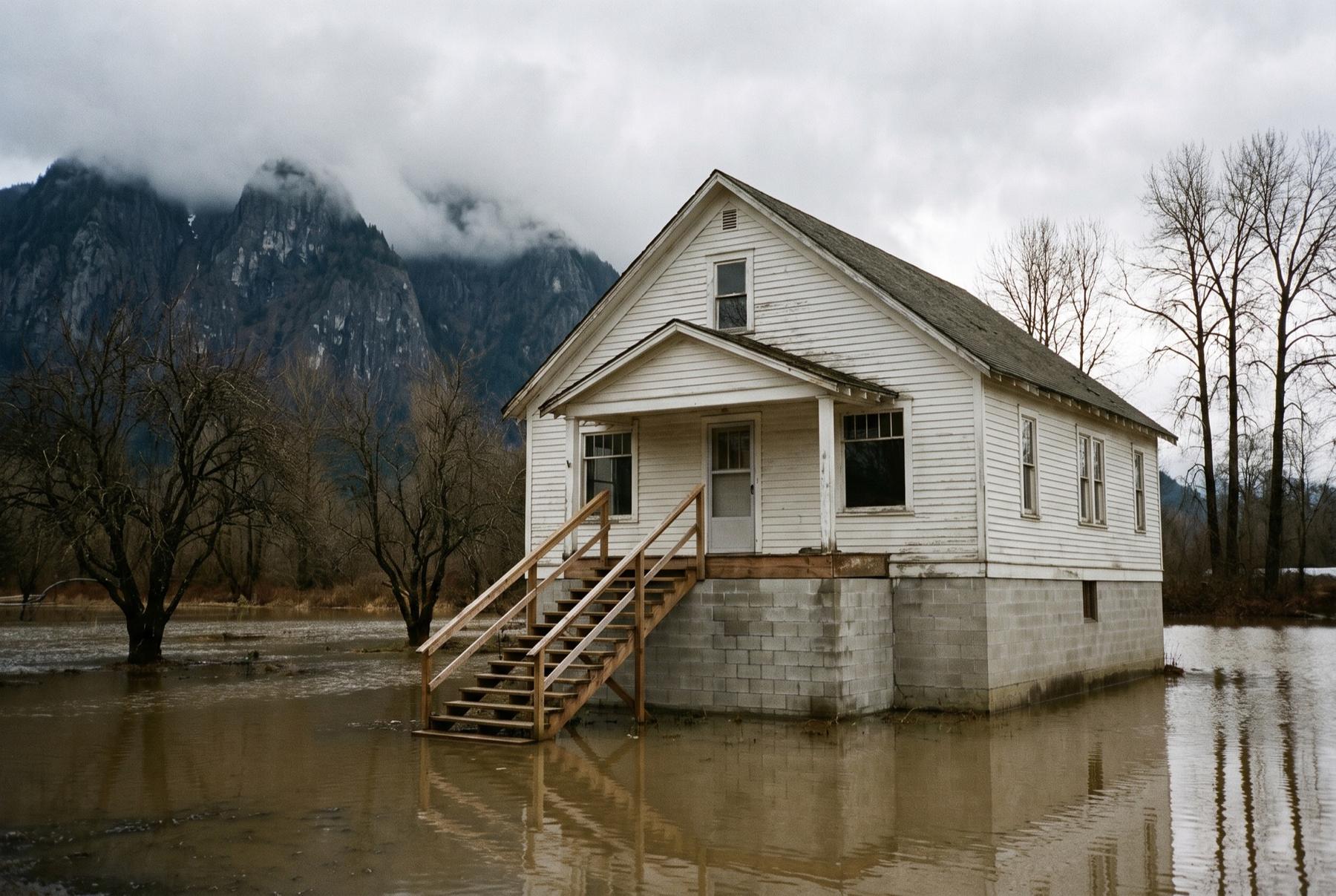
Snoqualmie ValleyA farmhouse raised above winter water, Mount Si in cloud.
Where the water goes: the three forks and the falls
Three rivers meet in the upper Snoqualmie Valley. The North Fork comes down out of the forest north of town. The Middle Fork runs in from the long valley east of Mount Si. The South Fork follows I-90 down from Snoqualmie Pass. They join between North Bend and Snoqualmie, and the combined river winds past Snoqualmie’s historic downtown before it drops over Snoqualmie Falls.
The falls matter as much as the forks do. The rock lip at the top acts like a narrow drain for the whole upper valley. When a warm, wet storm rolls in off the Pacific and dumps rain on the Cascades, often melting early snow at the same time, the forks rise faster than the water can get out over the falls. The river backs up and spreads across the flat ground between the two towns, over the Meadowbrook farmland and into low neighborhoods, and local roads close.
These floods are a winter event. The storms that cause them tend to arrive from late fall through February. The water usually comes up over a day or two and goes down over a few more, and in a big year it can come more than once in the same season.
King County’s Flood Warning Center tracks the Snoqualmie with river gauges and announces flood phases as the water rises. Residents can sign up for the county’s flood alerts, and anyone who buys in the valley should.
Reading the flood map for one address
Two houses a block apart in North Bend can sit on opposite sides of a flood zone line, so the research starts with the address itself.
- Find the FEMA zone. Look the address up in FEMA’s Flood Map Service Center or its National Flood Hazard Layer viewer. Zones beginning with A mark the Special Flood Hazard Area, the ground FEMA expects to flood in the event it uses as its baseline, often called the hundred-year flood. That name describes a probability. It can happen two winters in a row.
- Check King County iMap. Turn on the flood hazard layers. The county’s mapping sometimes adds detail beyond FEMA’s, and along some reaches it also shows channel migration zones, where the river itself may move over time.
- Note whether the parcel touches the floodway. The floodway is the main channel and the ground right beside it that carries fast water. Rules for building, adding on or rebuilding there are much stricter than in the rest of the floodplain.
- Call the floodplain administrator. The City of North Bend, the City of Snoqualmie and King County each have staff who handle floodplain permits. They can tell you what records exist for the address and what you could and couldn’t do to the house later.
A house outside the mapped zone can still take water from a clogged ditch, a high water table or a creek that isn’t on the map, which is why the seller’s answers below count as much as the zone.
When flood insurance is required, and the 30‑day wait
The lender’s requirement
If the home sits in a Special Flood Hazard Area and you’re buying with a federally backed or federally regulated mortgage, which describes most home loans, your lender will require flood insurance. The lender will order its own flood zone determination early in the loan process, so the question gets answered either way. It is better to know before you write the offer.
The waiting period
Policies through the National Flood Insurance Program generally don’t take effect until 30 days after purchase. There is an exception when the policy is bought in connection with making a loan, which is why a policy bought for a closing can start at closing. The details matter, so confirm the effective date with your insurance agent and your lender, and don’t leave the policy to the last week. If you are paying cash and choose to insure, the wait usually applies in full.
Where the policy comes from
You can buy an NFIP policy through most insurance agents, and private flood insurers also write coverage in the valley. An existing NFIP policy on the house can sometimes be assigned to the buyer, so ask the seller whether one is in place. Premiums now reflect property-specific factors, so ask for a real quote on the actual address during your inspection period and put that number in your budget before you commit. If the house sits outside the mapped zone, the lender won’t require a policy, though coverage is available and worth pricing.
The surveyor’s flood certificate, and houses raised on new foundations
FEMA has a certificate form, filled out by a licensed surveyor or engineer, that records how high the house sits, including its lowest floor, against the base flood level for that spot. Insurers rely on it, and so does the city’s permit desk. A seller who has one should hand it over. Cities with floodplain homes often keep these certificates on file, so ask the City of North Bend or the City of Snoqualmie whether one exists for the address.
Drive through old Snoqualmie and you’ll see houses that sit much higher than their neighbors, with a flight of stairs to the front door and a tall concrete foundation below. Many were raised over the years through flood reduction programs. A raised house can be a good buy. Look at a few things on the tour:
- The furnace, water heater and electrical panel should sit above the flood level, well clear of the space under the house.
- The enclosed area below a raised house is generally limited to parking, storage and access, with flood openings in the walls to let water in and out. A finished rec room or bedroom down there is a reason to pull the permits.
- Stairs and landings take the weather, so look at their footings and connections.
If the survey shows the ground right against the house sits at or above the base flood level even though the lot is mapped inside the zone, the owner may be able to apply to FEMA for a Letter of Map Amendment. That can change the insurance picture, so ask whether anyone has looked into it.
If you’re buying with remodel plans, know this rule first. In a floodplain, a large enough remodel or repair can require the whole house to be brought up to current flood standards, which often means raising it. Ask the floodplain administrator where that line falls for the specific home before you plan a kitchen around it.
What to ask the seller about past winters
Washington’s seller disclosure statement asks about past flooding, standing water and drainage problems, and whether the property includes floodplains or other critical areas. Read those answers, and then ask plainly:
- Has water reached the yard, the garage, the crawlspace or the living space, and in which winters?
- Does the road out go under water, and for how long?
- Have there been flood insurance claims or disaster assistance payments on the house?
- Is there a sump pump, and does it run all winter?
- Is there a current flood policy, and would it be assigned to a buyer?
On the tour, look for water lines on the foundation, silt in the crawlspace, newer drywall along the bottom of walls and rust on the lower parts of appliances. None of those settle the question alone. Together with the seller’s answers, they give you a picture of how the house has lived through its winters.
Looking above the floodplain in North Bend and Snoqualmie
Plenty of the valley sits well out of the water. Snoqualmie Ridge, up the hill from the historic town, is a planned community of newer homes on high ground. In and around North Bend, neighborhoods and wooded parcels on the rising ground toward the hills sit outside the mapped floodplain. Check street by street, since the zone lines don’t follow neighborhood names.
Higher ground has its own homework. Wooded lots near steep slopes can carry landslide hazard areas, and the benches above town get more snow than the valley floor. Rural parcels often run on a well and a septic system; the county process when one sells is covered in septic inspections in King and Pierce counties. Plenty of houses up there have a wood stove too, and the rules for using one on burn ban days are in wood stoves and burn bans. Farther south, Orting buyers face a related insurance question, covered in buying in Orting’s lahar zone.
When I set up a search here, flood zone is one of the limits we decide on at the start, alongside commute and distance to the trails you use. The search page explains how those limits work. Ruling the floodplain out entirely is a fair choice, and so is a raised house near downtown Snoqualmie with a good survey and a policy you understand.