Are There Old Coal Mines Under Houses in Black Diamond and Issaquah?
The short answerIn places, yes. Black Diamond, parts of Issaquah, and the Carbon River towns of Wilkeson and Carbonado were coal country, and some old underground workings lie beneath or near today’s neighborhoods. Before you buy, check the parcel on the city or county coal mine hazard maps, read the title report and seller disclosure, and bring in a geotechnical engineer if the maps show a hazard.

By Austin Hellickson, Managing Broker, LPT Realty7 min read
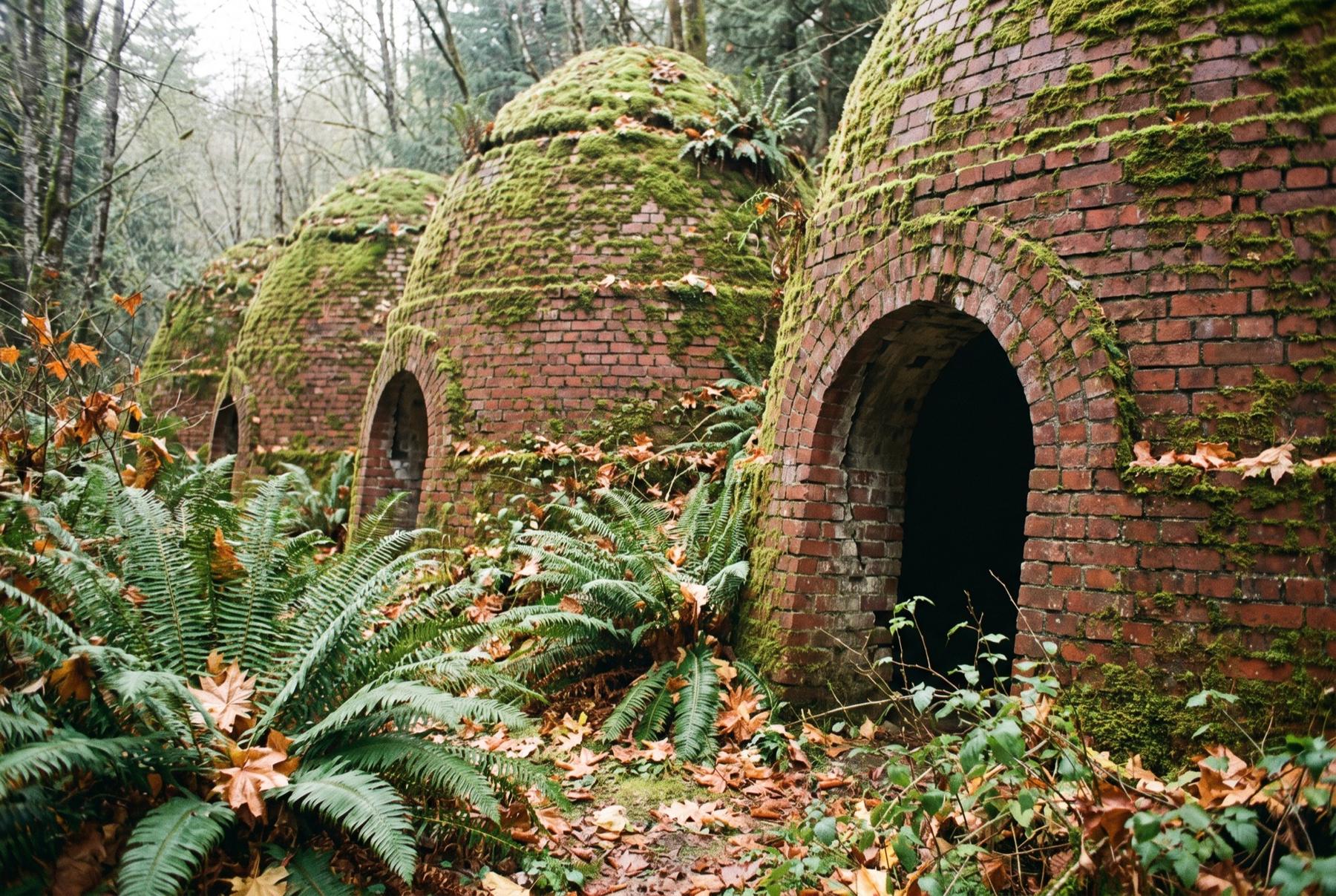
Carbon River coal countryOld coke ovens under second-growth forest.
Coal built a string of towns along the foot of the Cascades in the late 1800s and early 1900s. Trains hauled it to Seattle and Tacoma, and company towns grew up around the mine entrances. Most of those mines closed generations ago. The tunnels were abandoned in place and the towns carried on above them, which is why the question still comes up at the inspection stage.
What stayed behind is underground: tunnels, and the rooms where coal was cut out and left open or loosely backfilled. Some sit deep and some close to the surface, and depth decides most of whether they matter to the house on top.
Where the old mines are
Where the mining was, and whom to ask first about a parcel. Treat it as a starting point; it doesn’t list every mine in the region.
| Area | County | Where the mining was | Ask first |
|---|---|---|---|
| Black Diamond | King | Around the old town and east toward Franklin and the Green River Gorge | City of Black Diamond |
| Issaquah | King | Along the base of Squak Mountain and toward Grand Ridge | City of Issaquah |
| Newcastle and Cougar Mountain | King | Coal Creek and the slopes of Cougar Mountain | City of Newcastle, or King County outside city limits |
| Ravensdale and the rural edges | King | Scattered workings between Maple Valley and Black Diamond | King County |
| Wilkeson and Carbonado | Pierce | The Carbon River coal field in the hills around both towns | The town, then Pierce County |
What these towns are like to live in, above ground, is on the places page.
What a mine hazard looks like on the ground
Most of the time, nothing at all. Many old workings lie deep enough that the ground above them has been quiet for a century, and you could live there for decades without a sign.
Shallow workings are different. Old timber supports rot, roofs of abandoned rooms slowly collapse, and the ground above can sag into a shallow dip or, less often, open into a sinkhole. Wet winters tend to be when it shows. Old air shafts and mine entrances were often closed with timber or loose fill, and those plugs can decay too.
Around a house, movement tends to look like the ordinary signs of settling:
- Foundation cracks that keep widening, or a stair-step crack in a block wall
- Doors and windows that start sticking after years of working fine
- A low spot in the yard that holds water and wasn’t there before
- A garage slab or driveway that has dropped on one side
Every one of those has common causes that have nothing to do with mines: clay soil and poor drainage, mostly. That is exactly why a map and an engineer beat guessing from the curb.
Finding a parcel on the coal mine hazard maps
King County treats coal mine hazard areas as a type of critical area and sorts them by severity, from declassified areas that have been studied and found to be low risk, through moderate, to severe. Cities with mining history, including Black Diamond and Issaquah, write their own critical areas rules and keep their own maps. In unincorporated King County, the county’s iMap viewer shows sensitive areas layers you can check against a parcel.
Washington’s growth management guidelines ask counties and cities to classify coal mine hazards along with other geologic hazards, so Pierce County’s planning staff are the people to ask what has been mapped around a parcel in the Carbon River country. For Wilkeson and Carbonado, start with the town and ask which maps it relies on.
The maps are drawn from old mine records, and old mine records were not always complete, so the lines are approximate. A parcel just outside a mapped area is not proof of solid ground beneath it. And a parcel inside one may already have been studied, with the results sitting in a permit file.
What a geotechnical report can tell you
A licensed geotechnical engineer can tell you what a map can’t: how deep the nearest workings are, whether the house actually sits over them, and what the realistic risk is for that structure. Some reviews are done largely at a desk, using historic mine maps, geologic maps and earlier studies of nearby parcels. Others add fieldwork, such as test borings. The engineer will tell you which one the property needs.
A report is worth ordering when the parcel falls inside a moderate or severe mapped area, when the house shows signs of movement, or when you plan to build a shop or an addition. In that last case the permit office will likely require one anyway, so it makes sense to learn the answer before you own the land.
Engineers book up and reports take time, so build a long enough inspection or feasibility period into the offer. If the house was built or remodeled recently in a mapped area, ask the building department whether a report is already in the permit file. That can save weeks.
Questions for the seller, the title report and the building department
Washington’s seller disclosure form asks about settling, slippage and sliding, drainage problems and critical areas on the property, so read those answers closely. Then ask the seller directly about any foundation repair, any low spot that was filled, any engineering reports they have, and any insurance claims for ground movement.
In the title report, look for reservations of coal or mineral rights. Old deeds in coal country sometimes kept those rights with a mining company or a railroad. The title company can explain what a reservation like that means for you today. Some jurisdictions also record a notice on title when a permit touched a critical area, which is another clue worth following.
At the building department, ask for the permit history and any critical area review tied to the parcel. If the house is on septic, pull that file on the same trip; the two counties handle septic at sale differently, as covered in septic inspections in King and Pierce counties.
Does a mapped hazard rule a house out?
Not automatically. A declassified area has already been studied and found low risk. Plenty of homes in moderate areas were built with engineering that accounts for what lies below. Severe areas carry tighter limits, and a house there needs a hard look.
The bigger effects are often indirect. A mapped hazard can limit what you build later. Standard homeowners policies usually exclude earth movement, a point that also comes up in the article on buying in Orting’s lahar zone, so ask an insurance agent what coverage for subsidence is available and what it costs. Some eastern coal states run state mine subsidence insurance programs. Ask your agent what, if anything, is available for a property here. And when you sell, the next buyer will ask the same questions you’re asking now, which is one more reason to keep every report you pay for.
Some buyers walk away at this point, and that’s a fair call. Others get an engineer’s answer they’re comfortable with and buy near Lake Sawyer or at the foot of Squak Mountain.
Quick answers
- Does a home inspection check for old mines?
- No. A general home inspector looks at the house and may note cracks or settling, but judging what lies underground is work for a licensed geotechnical engineer. If the parcel is mapped or the inspector flags movement, that is the point to call one.
- Who keeps the old mine maps?
- The Washington Geological Survey, part of the Department of Natural Resources, holds a collection of historic coal mine maps. Cities and King County draw on records like these for their hazard maps, and geotechnical engineers use them in their reviews.
- Can I build a shop or a cottage on a lot in a coal mine hazard area?
- Often, with the right engineering, though it depends on the classification and the local code. Expect the permit office to ask for a geotechnical report, and talk with them during your feasibility period before you are committed to the purchase.
- Do the coke ovens in Wilkeson mean there are mines under the town?
- The ovens baked coal from the surrounding field into coke, so they show that Wilkeson sat in the middle of coal country. They don’t tell you what lies under any one lot. Check the specific parcel with the Town of Wilkeson and Pierce County.