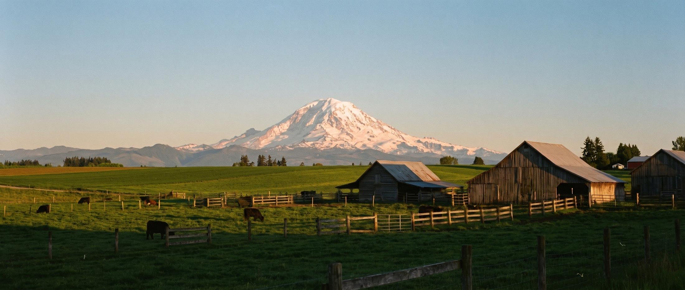
Snow-covered volcanic peak rising above green pasture, weathered wooden barns, rail fences, and grazing cattle in low evening light

Foothill and forest towns

Eight places between Mount Rainier and Snoqualmie Pass where HomeSquatch spends most of its time, with notes on character, housing and the roads in and out.

Mountain over pasture Enumclaw Plateau

South and east of Sumner

The plateau and the White River

Enumclaw

County
King
Zip
98022
Roads
SR 410, SR 164, SR 169
Schools
Enumclaw School District

Character

A farm town on a broad plateau, with Mount Rainier filling the southeast sky on a clear day. The downtown along Cole Street and Griffin Avenue has kept its older storefronts. The Enumclaw Expo Center hosts the King County Fair and the Enumclaw Pro Rodeo, and horses are part of daily life on the edges of town.

Housing

Older bungalows and ramblers close to downtown, newer subdivisions around the edges, and acreage with barns and pasture out on the plateau. If you want land and a small-town main street within a few minutes of each other, this is one of the first places to look.

Getting in and out

SR 164 runs to Auburn and SR 169 heads north toward Black Diamond and Maple Valley. SR 410 goes east past Mud Mountain Dam and Federation Forest State Park toward Crystal Mountain and Chinook Pass, which closes for the winter.
Buckley

County
Pierce
Zip
98321
Roads
SR 410, SR 165
Schools
White River School District

Character

Just across the White River from Enumclaw, in Pierce County. A small downtown, a logging history, and the Foothills Trail running out toward South Prairie and Orting. It feels a little quieter than its neighbor across the bridge.

Housing

Houses on the blocks around Main Street, a few newer neighborhoods, then rural property running toward the foothills and down to the river. Acreage buyers often end up comparing Buckley and Enumclaw side by side.

Getting in and out

SR 410 connects west to Bonney Lake and Sumner and east across the river to Enumclaw. SR 165 heads south toward Wilkeson and Carbonado.

Black Diamond

County
King
Zip
98010
Roads
SR 169
Schools
Several districts; confirm by address

Character

A former coal-mining town that still wears its history. The Black Diamond Museum sits in the old train depot, and the Black Diamond Bakery has been pulling people off SR 169 for a very long time. Lake Sawyer lies inside the city, and the Green River Gorge is a short drive east.

Housing

Mining-era houses in the old part of town, lakefront and lake-view homes around Lake Sawyer, rural parcels on the edges, and large newer master-planned neighborhoods. The range is wide, so the search has to be specific.

Getting in and out

SR 169 runs north to Maple Valley and Renton and south to Enumclaw. Back roads toward Ravensdale and Kent are useful when 169 is slow.

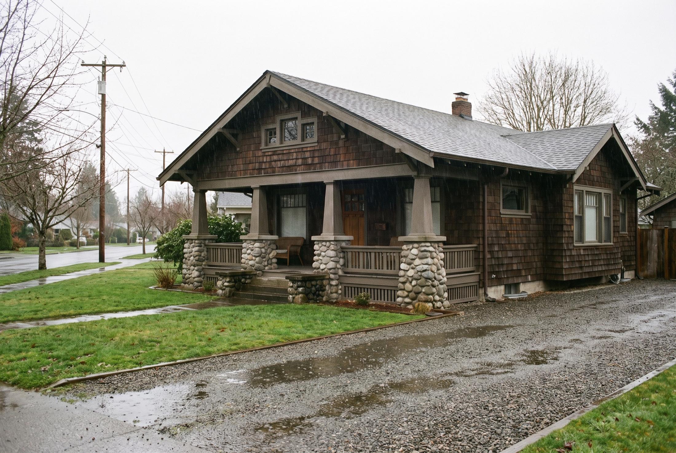
Brown cedar-shingle craftsman bungalow with a covered front porch on river rock piers, a wet lawn, and a gravel driveway on a rainy afternoon

Plateau townsA craftsman on a rainy afternoon, gravel drive and all.

Up toward the mountain

The Carbon and Puyallup valleys

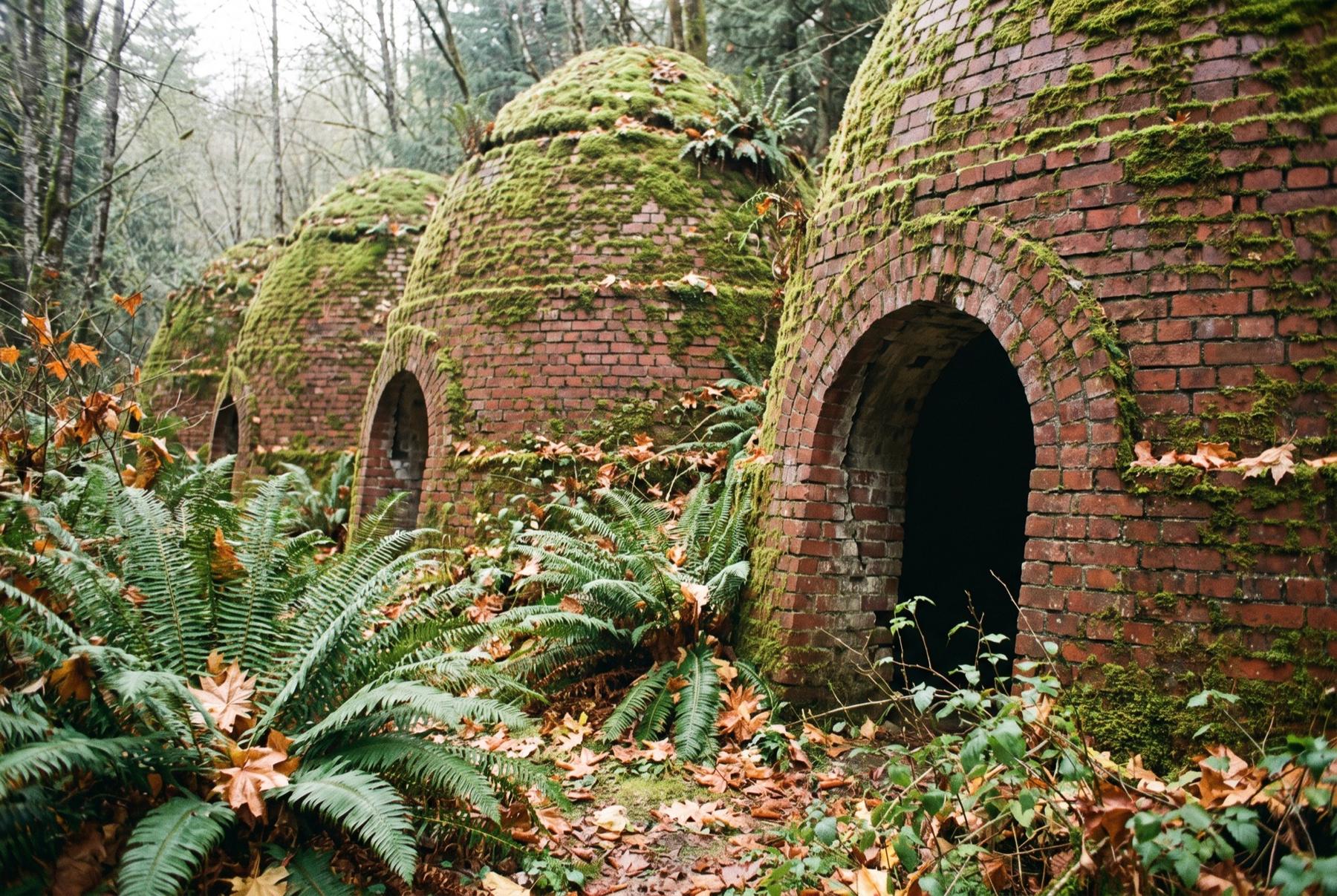
Row of old brick beehive ovens covered in moss, with arched openings, sword ferns and fallen leaves in front and forest behind

Carbon River countryOld brick coke ovens, gone to moss and fern.

Wilkeson

County
Pierce
Zip
98396
Roads
SR 165
Schools
White River School District

Character

One of the smallest towns on this page, at the foot of the Carbon River country. Sandstone from the Wilkeson quarry went into the Washington State Capitol in Olympia, and a row of historic coke ovens still stands at the edge of town. It is quiet in the way very small places are.

Housing

Small lots and older houses in town, with rural and wooded property in the hills around it. There are not many houses here at any given time, so a Wilkeson search takes patience and a willingness to move quickly when the right one appears.

Getting in and out

SR 165 runs north to Buckley and south through Carbonado toward the Carbon River entrance of Mount Rainier National Park. The road climbs past Carbonado, and winter driving gets harder the higher you go.

Orting

County
Pierce
Zip
98360
Roads
SR 162
Schools
Orting School District

Character

A valley town between the Carbon and Puyallup rivers, with a big central park and the Foothills Trail running straight through the middle. On a clear morning Rainier fills the head of the valley.

Housing

A small older core around the park, and newer subdivisions spread across the valley floor. Orting sits within a mapped lahar hazard zone for Mount Rainier. The area has a warning system and marked evacuation routes, and every buyer should read the USGS and county hazard information before buying here.

Getting in and out

SR 162 connects north to Sumner and Puyallup and east toward South Prairie and Buckley. Much of the commute traffic funnels through the same few roads, so drive them at your hour.

East of Lake Sammamish

Along I-90

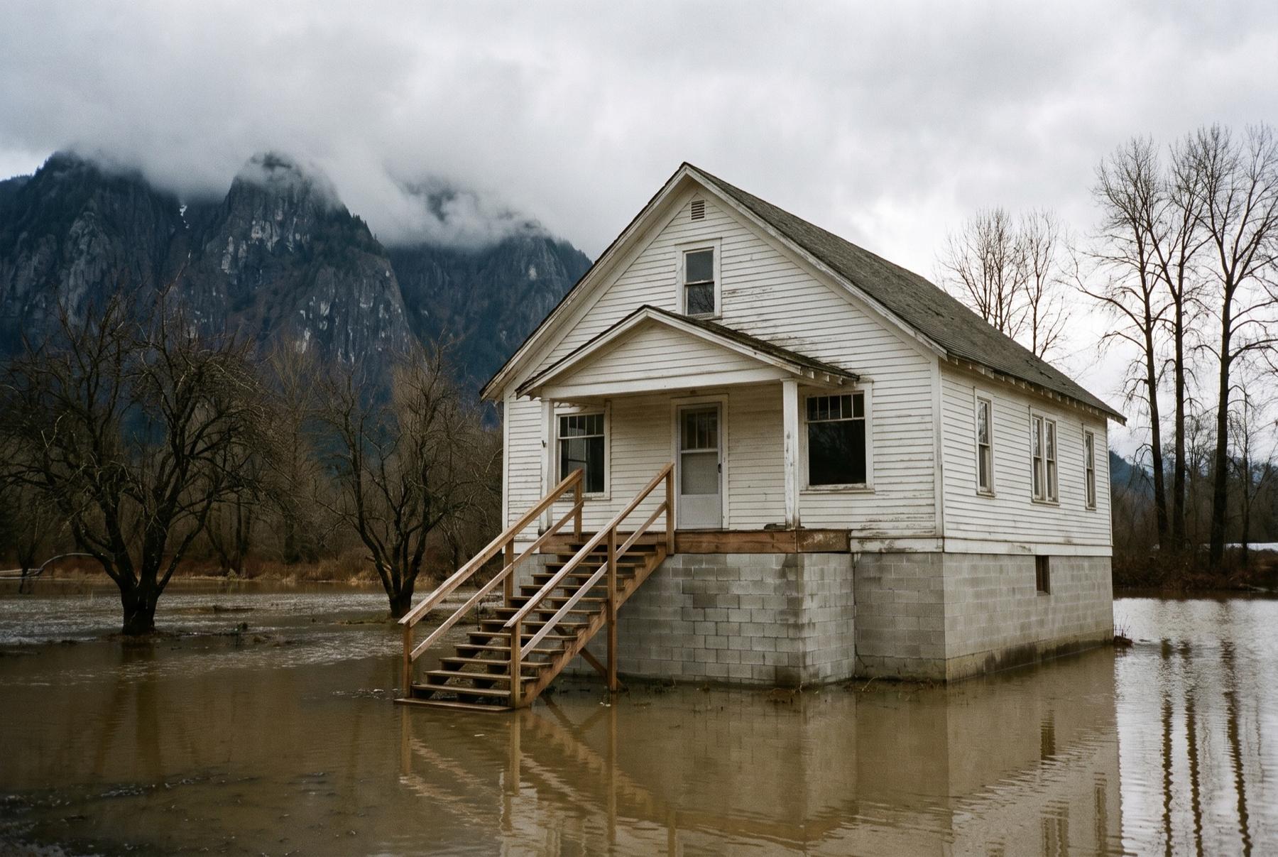
White farmhouse raised on a concrete foundation with high water pooled around it, bare cottonwoods and a steep, cloud-topped mountain behind
Snoqualmie ValleyWinter high water in the valley. Read the flood map first.

Issaquah

County
King
Zip
98027, 98029
Roads
I-90, SR 900
Schools
Issaquah School District

Character

The most suburban town on this page, and one of the easiest trail towns in the region. Tiger, Cougar and Squak mountains, the heart of the Issaquah Alps, all have trailheads minutes from town. Lake Sammamish State Park sits at the north end, and the salmon hatchery on Issaquah Creek is a short walk from Front Street.

Housing

Some older houses close to Front Street, midcentury houses on the wooded hillsides, and larger planned neighborhoods in the Issaquah Highlands and Talus. The hillside homes are where the trees and the views live.

Getting in and out

I-90 west to Bellevue and Seattle, east toward North Bend and the pass. SR 900 heads west toward Renton.

Snoqualmie

County
King
Zip
98065
Roads
I-90, SR 18, SR 202
Schools
Snoqualmie Valley School District

Character

Snoqualmie Falls sits just downstream of the old town. The historic downtown is home to the Northwest Railway Museum and its restored depot. Up the hill, Snoqualmie Ridge is a planned community of newer homes, parks and trails.

Housing

Small older houses in the historic town by the river, newer houses and townhomes on the Ridge. Parts of the old town sit in the Snoqualmie River floodplain, so check the flood maps and ask whether a surveyor has ever certified the height of the house’s lowest floor.

Getting in and out

The Snoqualmie Parkway and SR 18 connect to I-90. SR 202 runs through town toward Fall City in one direction and North Bend in the other.

North Bend

County
King
Zip
98045
Roads
I-90, SR 202
Schools
Snoqualmie Valley School District

Character

Mount Si stands over the town, and on most weekends the trail up it is busy. Rattlesnake Lake and Rattlesnake Ledge are just to the south, the Middle Fork Snoqualmie valley opens to the east, and the Snoqualmie Valley Trail runs right through. Downtown is small and walkable, strung along North Bend Way.

Housing

Houses on the blocks off North Bend Way, newer neighborhoods on the edges, and wooded lots out toward the river forks. Some areas sit in the floodplain of the three forks of the Snoqualmie River, so the flood map is part of every North Bend search.

Getting in and out

I-90 west to Issaquah and Seattle, and east over Snoqualmie Pass. SR 202 heads back toward Snoqualmie and Fall City.

Past these eight towns

Ravensdale, Maple Valley, Carbonado, South Prairie, Greenwater, Fall City, Carnation and Preston all come up in foothill searches too. Tell me where you’re looking. If it’s ground I don’t know well, I’ll introduce you to an agent in the Homexa network who does.